
The desert of the Sahara is one of those places which most people have heard about, but few know in detail. This was my first time seeing a detailed satellite map of the Sahara, but I was surprised at how much one desert could cover and how large it is – it’s about the size of the United States and crosses so many countries! It’s more than just endless dunes; it’s a land of towering mountains, ancient rock formations, hidden oases, and remarkable wildlife, which has evolved to survive one of the planet’s most extreme climates.
Whether you are interested in learning more about the Sahara Desert map, Sahara Desert Geography, Sahara Desert Climate or fascinating facts about the Sahara Desert in 2026, this guide will help you learn more about this incredible region.
Sahara Desert Map: Where Is It Located?
Sahara Desert is the largest hot desert in the world, and it is situated in North Africa. It is 9.2 million square kilometres (3.6 million square miles) in size, from the Atlantic Ocean in the west to the Red Sea in the east. Covers areas of 11 countries:
- Algeria
- Chad
- Egypt
- Libya
- Mali
- Mauritania
- Morocco
- Niger
- Sudan
- Tunisia
- Western Sahara
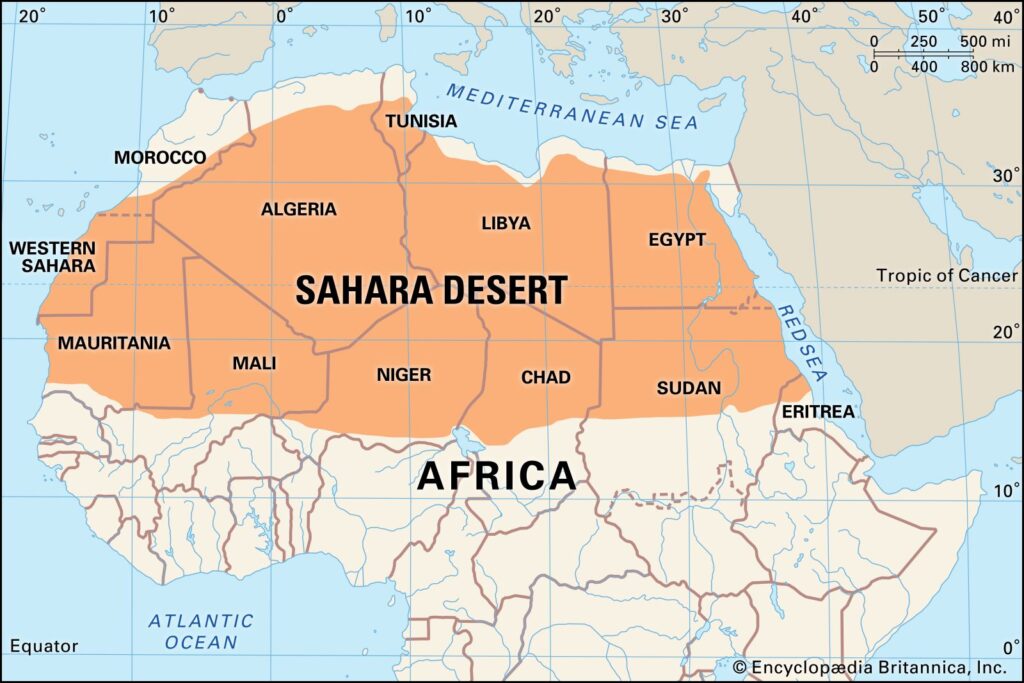
The Mediterranean Sea to the north and the Sahel, a transition region between the desert and the tropics, to the south. Although the Sahara is often called a desert of deserts, just 25% of it is made up of dunes. The rest is rocky plateaus, gravel plains, dry valleys, salt flats, volcanic mountains, and scattered oases.
Quick Facts About the Sahara Desert
- Area: Approximately 9.2 million sq. km
- Continent: Africa- Type: Hot desert
- Countries Covered: 11
- Highest Point: Emi Koussi in Chad (about 3,415 metres)
- Lowest Point: Qattara Depression, Egypt (about 133 metres below sea level)
- Permanent River: The Nile River
- Meaning of “Sahara”: Derived from the Arabic word for “desert.”
A Desert with a Green Past
The most interesting tidbit of information about the Sahara is that it wasn’t always barren. The area saw much more rainfall around 11,000 – 5,000 years ago, a time known to scientists as the African Humid Period. There were rivers, lakes, elephants, giraffes, hippos, and early human communities were found in grasslands.
Scientists are still researching the ancient cave paintings, fossils and sediments found in the lake to learn about this surprisingly green era in the Sahara’s history.
Climate and Weather
The Sahara experiences one of the harshest climates on Earth.
- The amount of rain is very restricted, and in some regions, winter nights are below 0°C.
- Rainfall is very limited and in some places less than 25 mm per year.
- Sometimes strong winds in the deserts can generate extensive sandstorms, which can span thousands of kilometres across continents and even the Atlantic Ocean.
- Plants and Animals that Survive the Extreme.
- The Sahara Desert is a seemingly barren landscape, but it harbours a host of species that are rarely seen.
Some of the characteristic flora are:
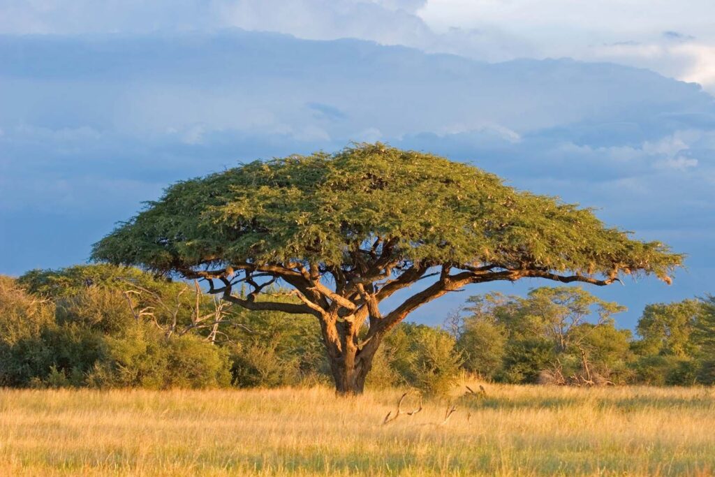
- Acacia trees
- Date palms
- Tamarisk shrubs
- Desert grasses
- Succulent plants
The Sahara has these kinds of animals:
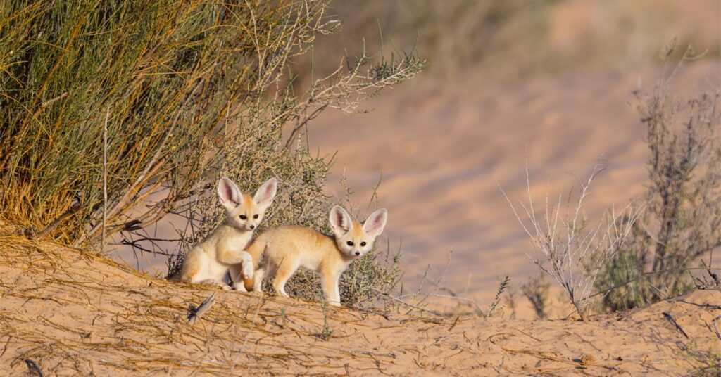
- Fennec foxes
- Addax antelopes
- Dorcas gazelles
- Saharan cheetahs
- Desert crocodiles (in isolated wetlands)
- Horned vipers
- Scorpions
Many reptiles and birds of prey fly across the deserts in search of prey.
In the course of evolution, these species have developed amazing adaptations to withstand extremely high temperatures and extended periods of drought.
Why the Sahara Matters in 2026?
The Sahara is increasingly important for scientific research and for the conservation of the environment. Researchers are studying the desert in order to gain more knowledge of weather patterns, climate change and desertification, which can affect rainfall on other continents of Africa as well.
The Great Green Wall is one of Africa’s most ambitious environmental initiatives, working to rehabilitate lost areas across the Sahel and limit the spread of desertification by enhancing biodiversity and providing for local communities.
Interesting Sahara Desert Facts
- The Sahara is the largest hot desert but the third-largest desert overall, after Antarctica and the Arctic.
- The high dunes are more than 150 metres (500 ft) tall.
- Certain mountain peaks in the Sahara occasionally receive snow, despite the desert’s extreme heat.
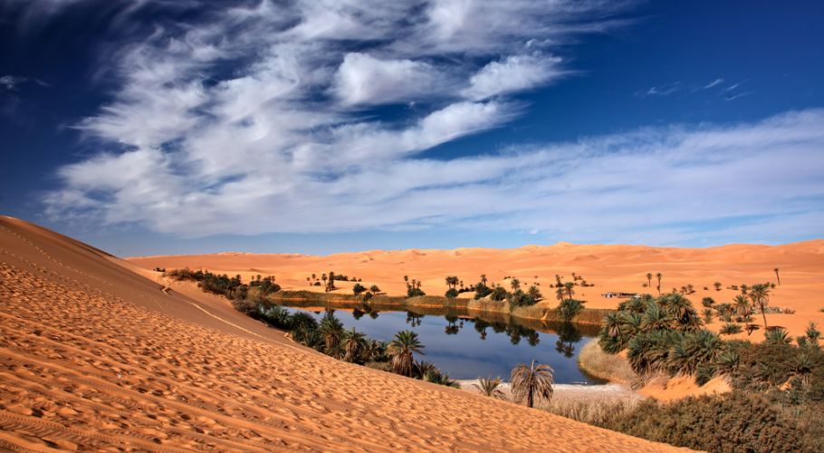
- There are scores of natural oases dotted throughout the desert, which draw their water from underground aquifers.
- Rock artwork unearthed in various locations across the Sahara has revealed that the area was once inhabited by people and had an abundance of wildlife.
Final Thoughts
The Sahara Desert is far from being an expanse of sand. It’s a territory of millions of years of geology, deeply cultural history and amazing natural strength. From hidden oases and ancient civilisations to towering dunes and rare wildlife, every part of the Sahara tells a story.
The Sahara Desert is one of the world’s most amazing natural wonders, whether you’re a geography buff, a traveller looking to do something new one day, or just someone who’s interested in our planet’s extreme environments. Knowledge of its geography, history and ecological significance in 2026 teaches us that even the extreme environment of the Earth has life, mystery and scientific value.
About the Author